Do you dream of parking the car and stepping into a day of trails, coffee, and live music without checking your gas gauge? In Missoula, that lifestyle is not only possible, it is one of the best ways to soak up the city’s character. Whether you want riverfront sunsets, university energy, or quick errands by foot, you will find pockets where walking makes daily life simple. This guide breaks down Missoula’s most walkable neighborhoods, the trade-offs to expect, and how to choose the right fit for you. Let’s dive in.
What walkable means in Missoula
Missoula’s citywide Walk Score sits in the mid-40s, a generally car-dependent rating. That does not tell the whole story. Several neighborhoods offer strong walkability where coffee, concerts, errands, and trails are an easy stroll. Start with a quick scan of the Walk Score overview for Missoula to compare areas.
What makes walking work here is a tight downtown core, the Clark Fork riverfront trail network, and a dense cluster of cafes and venues near Higgins Avenue. The Kim Williams Nature Trail connects to a larger path system and links neighborhoods to downtown and campus, which is ideal if you prefer walking or biking to daily fun. Learn more about the route and access points on the Kim Williams Nature Trail page.
Caras Park is your cultural backyard if you live near downtown. It hosts community events like Out to Lunch, Downtown ToNight, and the River City Roots Festival. You can confirm programming and location details on the Caras Park event page. Pair that with nearby venues like The Wilma and Top Hat, which you can scan on the local Missoula venues list, and you have a full evening without starting your engine.
Neighborhoods to consider
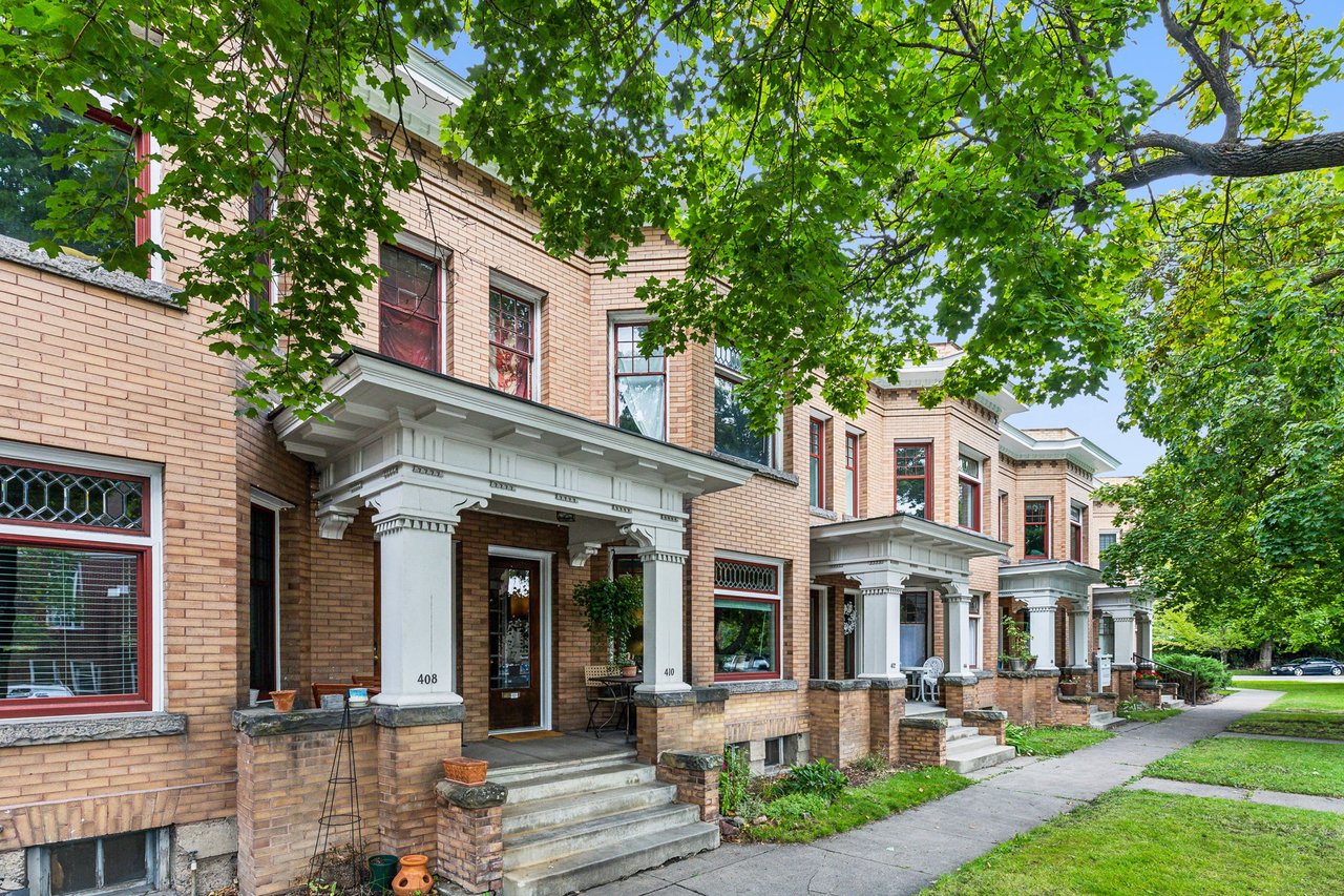
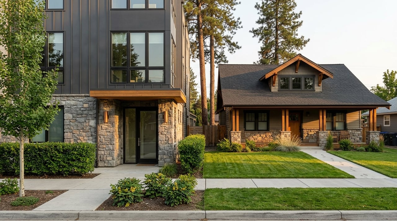
Downtown / Heart of Missoula & Riverfront
- Why you will like it on foot: You are steps to Caras Park, the riverfront paths, and the Hip Strip’s cafes and shops. You can grab a pour-over at Drum Coffee, stroll the river, and catch a show at The Wilma in one loop. The energy is steady, especially when the park and venues light up.
- Housing snapshot: You will find a mix of historic homes, condos, apartments, and newer infill near the Old Sawmill District. Condos and smaller homes are often your entry point if you want to live in the center.
- Trade-offs: Expect event noise at times and a higher concentration of renters in some blocks. If you are exploring river-adjacent properties, review parcel-specific maps on Missoula County’s floodplain resource before you buy.
University District
- Why you will like it on foot: Campus is your neighbor, so walking to lectures, performances, and coffee is part of everyday life. Riverfront paths and the Kim Williams Trail are close, which makes a car-light routine easier.
- Housing snapshot: The area blends older single-family homes with small multi-unit properties and some townhomes or condos. Blocks closest to campus can see more turnover.
- Trade-offs: The scene can be lively when classes are in session. If you want a quieter vibe, look a few blocks off primary student corridors and confirm occupancy patterns in listing notes.
Rose Park (Slant Streets)
- Why you will like it on foot: Leafy streets, sidewalks, and quick access to Higgins and the Hip Strip make Rose Park comfortable for daily walking. Walk Score’s Rose Park page confirms it as one of the city’s most walkable spots.
- Housing snapshot: Early 20th-century bungalows and ranches dominate, many with updates and modest yards. You get residential calm with easy access to coffee and downtown.
- Trade-offs: Nightlife is not at your doorstep like downtown, but it is a short walk or bike away. Inventory can be tight due to steady demand for its central location.
Lower Rattlesnake
- Why you will like it on foot: Nature is at your door. Greenough Park, Rattlesnake Creek, and Mount Jumbo trailheads are a short walk from many homes. You are close to downtown but live with a peaceful, wooded feel.
- Housing snapshot: Think early 1900s cottages and Craftsman homes with character, plus some renovated properties. The strength here is outdoor access, not a dense retail grid.
- Trade-offs: Fewer shops inside the neighborhood mean more trips toward downtown for errands. If you are considering the outer edges toward the canyon, study local wildfire guidance as part of your due diligence.
Southgate Triangle & Franklin-to-the-Fort
- Why you will like it on foot: Everyday retail is nearby, including grocery options and the Southgate area. The Bitterroot Trail connections and transit access make this a very practical place for car-light living.
- Housing snapshot: Mid-century ranch homes, apartments, and new infill are common. You get strong errand-level walkability without paying downtown premiums.
- Trade-offs: You are farther from the riverfront scene and festival action. Transit helps bridge that gap, so check routes and timing on Mountain Line’s map and schedules.
Lewis & Clark (Playfair Park area)
- Why you will like it on foot: Playfair Park and Splash Montana are central to the neighborhood’s appeal. Sidewalks and tree-lined streets support an easy daily loop to green space.
- Housing snapshot: Mostly mid-century single-family homes with yards and quieter streets. It suits buyers who value park access over nightlife.
- Trade-offs: Shops are within a reasonable walk in select corridors, but many errands will be a short bike or transit hop away.
How to choose your walkable fit
Use this quick checklist to match your lifestyle with the right neighborhood.
- Map a typical day on foot. List your essentials: a coffee spot, a grocery option, a music venue, and a favorite park or trail. Then test the route in a map app or in person. Start with the Walk Score map for Missoula to compare blocks, but validate in real life.
- Confirm trail access. If river walks or bike commutes matter, prioritize neighborhoods near the river corridor and the Kim Williams, Milwaukee, or Bitterroot trails. Get a feel for the route on the Kim Williams Nature Trail page and expand from there.
- Check transit as a force-multiplier. Zero-fare Mountain Line service connects the University, Downtown, and Southgate. Routes can turn a 25-minute walk into a 7-minute ride. Review your nearest stops on Mountain Line’s maps and schedules.
- Review floodplain details if you love the river. Some downtown and river-adjacent parcels sit in mapped flood zones. Look up the specific address on Missoula County’s floodplain maps early in your search.
- Understand wildfire risk at the edges. Hillside and canyon locations can carry higher wildfire considerations. Before you fall for a trail-adjacent property, scan the county’s wildfire preparedness guidance and ask about defensible space.
- Consider turnover near campus. Blocks closest to the University often have more rentals and seasonal noise. If you want a steadier pace, focus a few blocks outward and verify occupancy types with your agent.
- Time the walk. Visit at different hours to test noise, lighting, and foot traffic. Evening checks can be especially helpful near venues or busy corridors.
Sample everyday adventures by neighborhood
Need help picturing a car-light day? Try these quick loops.
- Downtown / Riverfront: Start with coffee at Drum Coffee or on the Hip Strip, wander the riverfront, grab dinner, then walk to a show listed on the Missoula venues guide. If it is a weekday in summer, end with an event at Caras Park.
- Rose Park: Walk or bike down Higgins to the Hip Strip for a cone at Big Dipper Ice Cream, hop onto the Milwaukee or riverfront trails for golden hour, and loop home through tree-lined side streets.
- University District: Cut across campus to the Kim Williams Trail, pause by the river, and return through neighborhood cafes. On event nights, skip parking altogether and walk to a performance.
- Lower Rattlesnake: Stroll through Greenough Park to the Clark Fork, then climb a trail on Mount Jumbo before dinner downtown. Bring a headlamp if you like twilight walks in shoulder seasons.
- Southgate Triangle / Franklin-to-the-Fort: Run errands on foot, connect to the Bitterroot Trail for a ride toward downtown, and take Mountain Line back if your legs are done for the day.
Work with a local guide
Choosing a walkable home in Missoula is about more than a single score. It is about how you live: morning runs, evening music, weekend markets, and where your favorite coffee sits on the map. We help you read the nuances block by block, check trail and transit access, and balance lifestyle with budget, hazards, and long-term plans.
Ready to find a home that matches your everyday adventure? Reach out to Crystal Ault to map your options and tour neighborhoods on foot.
FAQs
Which Missoula neighborhoods are most walkable for coffee, music, and river trails?
- Downtown/Heart of Missoula and Riverfront top the list for Caras Park events and venues, with Rose Park close behind for leafy walks and Hip Strip access.
How accurate is Walk Score for Missoula walkability?
- It is a great starting point for comparing areas, but it can miss trail proximity and parks, so pair the Walk Score map with on-the-ground checks.
Can I live mostly car-light in Southgate Triangle or Franklin-to-the-Fort?
- Yes for daily errands and transit, with quick access to shopping and Mountain Line routes; downtown and riverfront will be a bike or bus ride.
What should I know about floodplains near the Downtown Riverfront?
Which areas offer the best trail access within city limits?
- Lower Rattlesnake stands out for Greenough Park and Mount Jumbo trailheads, while University District and Riverfront offer quick links to the Kim Williams and riverfront paths.